What is RTK2go map and why is it important for precision work?
The RTK2go map visualizes a global network of community-contributed RTK base stations, offering free, real-time kinematic (RTK) correction data. It's crucial for precision work as it enhances standard GPS accuracy from meters down to centimeters, vital for applications like precision agriculture, surveying, and drone mapping.
How can I view RTK2go station coverage in my region?
You can view RTK2go station coverage directly on the official RTK2go website. The interactive map displays all active base stations, allowing you to zoom into your specific region, identify nearby stations, and check their operational status and connection details.
Is RTK2go free to use for real-time kinematic corrections?
Yes, RTK2go operates on a community-driven model, making its real-time kinematic correction data generally free for anyone to use. Users contribute their own base stations, and the data is then made publicly available, fostering widespread access to high-precision GNSS corrections.
What equipment do I need to utilize RTK2go data?
To utilize RTK2go data, you typically need an RTK-capable GNSS receiver, an internet connection (via cellular or Wi-Fi) for NTRIP client functionality, and software that can process the correction streams. This setup allows your receiver to connect to an RTK2go station and apply the corrections.
How do I troubleshoot connection issues with an RTK2go station?
Troubleshooting involves checking your internet connectivity, verifying the NTRIP client settings (IP address, port, mountpoint), ensuring your RTK receiver is properly configured, and checking the RTK2go map for the station's operational status. Sometimes, switching to a closer or more stable station can resolve issues.
Can RTK2go data be used for drone mapping projects?
Absolutely. RTK2go data is highly beneficial for drone mapping projects, providing the centimeter-level accuracy required for generating precise orthomosaics and 3D models. Drones equipped with RTK receivers can receive corrections via RTK2go, significantly reducing the need for ground control points.
Where can I find user reviews or performance feedback for specific RTK2go stations?
While there isn't a dedicated review system on the RTK2go platform itself, user communities and forums often share insights and performance feedback. Websites like rtk2go.com also provide uptime statistics and historical data for individual stations, which can indicate reliability.
RTK2go map RTK network real time kinematic GPS correction data precision agriculture map surveying RTK drone mapping RTK RTK base stations find RTK RTK coverage NTRIP client RTK accuracy.
Discover the RTK2go Map an essential tool for precision GPS applications in 2026. This informational guide targets Gen Z and younger Millennials providing a direct and practical overview of how to leverage real time kinematic positioning. Understand its utility in fields like agriculture surveying and drone technology to achieve unparalleled accuracy. The RTK2go Map visualizes available base stations globally allowing users to quickly identify optimal correction sources. Learn how this free community driven network empowers highly precise location data for diverse professional and hobbyist projects. This resource helps you navigate the platform find local stations and troubleshoot common issues ensuring your projects benefit from the latest in GNSS correction services. Stay ahead in precision mapping and data collection.
Frequently asked questions
What is the primary function of the RTK2go map?
The RTK2go map displays a global network of RTK base stations, offering free, high-accuracy GPS correction data. Its primary function is to help users locate nearby stations for centimeter-level positioning, crucial for precision tasks in surveying, agriculture, and drone mapping.
How does RTK2go enhance GPS accuracy?
RTK2go enhances GPS accuracy by transmitting real-time correction data from stationary base stations to moving receivers. This data corrects errors present in standard GPS signals, reducing positional inaccuracies from several meters to just a few centimeters, crucial for precision applications.
Is there a subscription fee to access RTK2go data?
No, RTK2go operates as a free, community-driven service. Individuals and organizations contribute their base stations, and the correction data is made publicly available without any subscription fees. This open access fosters widespread use of high-precision GNSS technology, benefiting many users globally.
What kind of devices are compatible with RTK2go services?
Devices compatible with RTK2go services typically include RTK-enabled GNSS receivers, professional surveying equipment, precision agriculture systems, and advanced drone platforms. These devices must support NTRIP (Networked Transport of RTCM via Internet Protocol) for receiving the real-time correction streams effectively.
How do I find available RTK2go base stations near me?
You can find available RTK2go base stations near you by visiting the official RTK2go website and using its interactive map. Simply zoom into your desired location, and the map will display active stations, their status, and crucial connection details necessary for your RTK receiver setup.
Can I contribute my own RTK base station to the RTK2go network?
Yes, RTK2go encourages users to contribute their own RTK base stations to expand the network's coverage. You'll need an internet-connected GNSS receiver and follow the specific setup instructions provided on the RTK2go website to configure your station as a public NTRIP caster.
What are common applications for RTK2go in 2026?
In 2026, common applications for RTK2go include precision agriculture for optimized planting and harvesting, land surveying for accurate boundary measurements, drone mapping for highly detailed aerial imagery, construction layout, and various scientific research requiring sub-meter accuracy.
Welcome to your essential guide to the RTK2go Map a critical resource for anyone seeking centimeter level accuracy in their positioning data. Whether you're a burgeoning agritech innovator a precise surveyor or a drone enthusiast this map is your gateway to real time kinematic corrections. Designed for mobile dependent users our quick overview gets straight to why you need to know about RTK2go in 2026.
Frequently Asked Questions
Where can I find the most reliable RTK2go stations in my local area?
The RTK2go Map is your go-to. Look for stations near major agricultural hubs or urban development zones for optimal coverage and consistent data streams.
How do I use the RTK2go Local MAP to plan my route for optimal signal?
Pull up your preferred mobile Maps app and use the station's coordinates from the RTK2go Map to verify real-time status. Plan your field work during peak signal times shown on the map for best results.
What are the best times to access RTK2go data for peak accuracy?
Optimal accuracy is typically during clear weather conditions when satellite signals are strongest. Check the RTK2go Map for station uptime and current satellite visibility before starting critical tasks.
Key RTK2go Map Considerations:
- Station Type: Public NTRIP Broadcaster
- Ideal Placement: Open fields elevated points clear sky views
- Data Source: Global GNSS networks
All maps focus on RTK2go map
Key highlights
Real time kinematic positioning global coverage precision agriculture surveying applications drone mapping user friendly interface station availability network status free community driven GNSS correction data.
Gallery
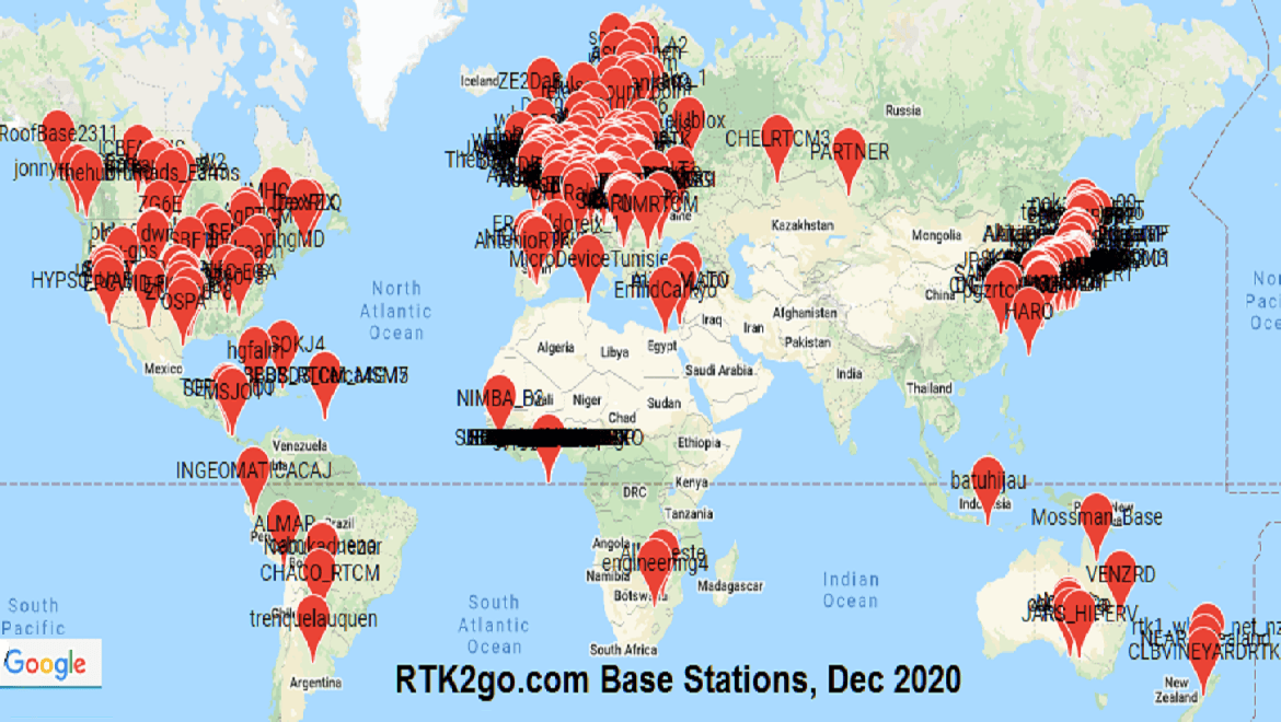


RTK2GO Hassle Free RTK NTRIP Streaming RTK2GOBASESTATIONS DEC2020 RTK2GOBASESTATIONS DEC2020 RTK2GO Station RTK2GOPUSHINUSERS RTK2GO Kostenloser Community Caster F R Live Korrekturen RTK2GO Gratis Correctiesignalen Ontvangen Voor Nauwkeurige RTK2GO Casters Wereldwijd RTK2GO 2024 Function Enhanced In GO Base Map 6662D0AC2D79B Release Changes SNIP Support AZUS ZOOMS4UP RTK2GOBASES NEAR Pol Quickmap RTK2GO Real Time Status RTK2GO Snipasavl RTK2GO The Global Service Youtube Maxresdefault How To Connect RTK2GO Typicalbasestations AUG2019.
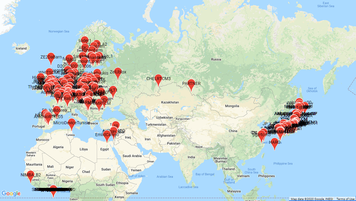


RTK2GO Hassle Free RTK NTRIP Streaming RTK2GOBASESTATIONS2 DEC2020 RTK2GOBASESTATIONS2 DEC2020 RTK2GO Nearserbia RTK2GO Tukiasemat Suomessa Youtube Maxresdefault Premium Positioning Portal Livemap Guide Nivtu LGFCP1ZLPY4HLOJBCGL9ACAFHRHQ Korjaussignaali Ilmaiseksi A7404D E214BF80C34641A5945D135C022A1271MV2 A7404D E214BF80C34641A5945D135C022A1271MV2 Midlands Network Expands Image Corrections Hotspot And Cellular Data Rates How It Works 7F5BD59F9CF7AEF18591D8C3DCD2420EE60C022C Mobile Base Using RTK2GO Leica GNSS GS05 Captivate Internet Rover With RTK2GO Trimble R12 R12I Receivers The Ultimate Risk Map Of 2026 SAFETURE Riskmap 2026 EN Scaled 2026 Rutherford GO 2026 Construction Update Route Railway News 236809 2026 236809 2026 R S Tailteann 2026 Announced Rastailteann Cycling Ras 2026.



Your Pok Mon GO Fest 2026 In Person Experience Checklist Hub Tokyo Map New Oregon Wildfire Risk Maps Show Which Properties Are Danger Kgw Com C9C45B28 80d6 497B A2B6 209092D4D7DE C9C45B28 80d6 497B A2B6 209092D4D7DE Pilotbyte RTK Network C8CA32 16b4 17EF B5B FC5F00C1A7CE Screenshot 2026 At PM C8CA32 16b4 17EF B5B FC5F00C1A7CE 2026 Toronto Is Getting Five Brand Stations By 2026 Urbanized 9473 Smarttrack Mto 9473 Nov Mapy Google 2026 Sa Stan Va M Osobn Digit Lnym Prorokom How Were Reimagining With G Width 2200 Format Webp 2200 2026 Archives E79981B1B36861A2ED07A1BA65D62322 Metronet Internet Plans And Deals Reviews Org T Mobile Nonpriority Availability Settings Premium Positioning 1XNDSKLATBZIEEG19XMXRI2SKJDRZP Rsw 1XNDSKLATBZIEEG19XMXRI2SKJDRZP International Road 2026 Cor Con CORCONINTERNATIONALROADMAP2026 Unveils Mobility Plan For 2026 World Cup Traffic 8829 FIFA Around Guide March 2026 Scaled 8829 2026 Rally Raid Frica Eco Race 2026 Route Africa 2026 2026.